

About Gwaldam - Where Garhwal Meets Kumaon
Perched at 1,708 meters in the Chamoli district of Uttarakhand, Gwaldam is a serene hill station that occupies a unique geographical position at the gateway between the Garhwal and Kumaon divisions. This tranquil hamlet, nestled amidst dense oak and pine forests, rewards visitors with some of the finest panoramic views of the Himalayan ranges accessible by road, with the majestic Trishul (7,120m) and the graceful Nanda Ghunti (6,309m) dominating the skyline.
Unlike the bustling hill stations of Uttarakhand, Gwaldam has remained largely untouched by mass tourism. This is a place where time moves slowly, where apple orchards bloom in spring, where sacred lakes lie hidden in ancient forests, and where the only sounds are birdsong and the gentle rustling of oak leaves. The town sits along the Karnaprayag-Bageshwar highway, making it a natural transit point, yet most travelers pass through without realizing the treasures that lie just off the main road.
Gwaldam is also the gateway to the legendary Roopkund Trek, one of India's most famous high-altitude treks leading to the mysterious Skeleton Lake at 4,800 meters. The Government Angora Farm, one of the few in India, adds a unique dimension to this destination, where visitors can learn about Angora rabbit rearing and purchase authentic wool products. Whether you seek spiritual solace at the ancient Naag Temple, adventure on Himalayan trails, or simply the peace of untouched mountain beauty, Gwaldam delivers an experience that lingers long after you leave.
Trishul & Nanda Ghunti Views
Stunning Himalayan panorama from town
Sacred Lakes & Temples
Gwalnaag Tal, Macchi Tal, Tali Tal
Roopkund Gateway
Starting point for the Skeleton Lake trek
Angora Farm & Orchards
Unique wool farm and apple gardens
Lakes & Natural Wonders of Gwaldam
Gwaldam is blessed with several pristine lakes, each with its own character and charm. These water bodies, set amidst dense forests and surrounded by Himalayan peaks, form the natural and spiritual heart of the region. The lakes are not just scenic attractions but hold deep cultural and religious significance for the local communities.
Gwaldam Lake (Gwalnaag Tal)
Location: 1 km from town centre
Type: Sacred lake with Naag Temple
Surroundings: Dense oak forest
Best Time: Early morning for reflection
Macchi Tal (Fish Lake)
Location: 2.5 km trek from town
Type: Fish-shaped natural lake
Surroundings: Oak & rhododendron forest
Best Time: March - November
Angora Farm - A Unique Attraction
The Government Angora Farm in Gwaldam is one of the few Angora rabbit breeding centres in India. Established to promote cottage industry and wool production in the hills, this farm is a delightful stop for families and anyone curious about sustainable mountain livelihoods. The fine Angora wool produced here is used to craft premium shawls, caps, and garments that are sold at the on-site shop at government-regulated prices.
One of the few Angora rabbit breeding centres in India
Produces fine Angora wool used in premium shawls and garments
Educational tours explaining the wool extraction process
Beautiful garden setting with Himalayan backdrop
Small shop selling Angora wool products at reasonable prices
Panoramic Himalayan Views from Gwaldam
One of Gwaldam's greatest treasures is its unobstructed panoramic view of the Himalayan ranges. Standing at the Trishul Viewpoint near the GMVN Rest House, the entire snow-capped wall of peaks stretches across the horizon. The views are most spectacular during autumn and winter mornings when the air is at its clearest and the peaks glow golden at sunrise.
Trishul
7,120mDistance: ~40 km
The trident-shaped peak sacred to Lord Shiva, dominating Gwaldam's skyline
Nanda Ghunti
6,309mDistance: ~35 km
The veiled goddess peak, stunningly visible from Gwaldam meadows
Nanda Devi
7,816mDistance: ~65 km
India's second highest peak and a UNESCO World Heritage Site
Nanda Kot
6,861mDistance: ~55 km
The fortress of Nanda, a striking pyramid-shaped peak
Other Visible Peaks
Treks & Nature Walks from Gwaldam
Gwaldam is a haven for trekkers and nature walkers alike. From gentle lakeside strolls to the legendary Roopkund expedition, the trails around Gwaldam cater to every fitness level. The region's forests of oak, pine, and rhododendron provide shade and beauty, while the Himalayan backdrop ensures every step is accompanied by grandeur.
Gwaldam to Roopkund Trek (Base)
7-8 Days (full trek) | 53 km total
Max: 4,800m (Roopkund)Gwaldam serves as the gateway to the legendary Roopkund Trek, famous for its mysterious skeleton lake at 4,800m. The trail passes through dense forests, alpine meadows, and offers unmatched Himalayan panoramas.
Start Point: Gwaldam / Wan Village | Best Time: May - June, September - October
Gwaldam Lake Trail
1-2 Hours | 2 km round trip
Max: 1,700mA gentle walk through oak forest leading to the sacred Gwalnaag Tal, surrounded by dense vegetation and home to the revered Gwaldam Naag Temple. Ideal for morning strolls and meditation.
Start Point: Gwaldam Town Centre | Best Time: Year-round
Macchi Tal Trek
3-4 Hours | 5 km round trip
Max: 1,750mA rewarding short trek to the uniquely fish-shaped Macchi Tal, nestled in a dense forest clearing. The still waters reflect the surrounding oak and pine trees, creating a photographer's paradise.
Start Point: Gwaldam Bus Stand | Best Time: March - November
Tali Tal Nature Walk
2-3 Hours | 4 km round trip
Max: 1,680mA peaceful walk to the lesser-known Tali Tal through charming Kumaoni villages and terraced fields. The trail offers an authentic glimpse into rural Himalayan life with minimal crowds.
Start Point: Gwaldam Market | Best Time: Year-round
Local Cuisine & Culture of Gwaldam
Sitting at the crossroads of Garhwal and Kumaon, Gwaldam offers a unique blend of both regional culinary traditions. The food here is simple, wholesome, and deeply connected to the mountain landscape - prepared with local grains, lentils, and vegetables grown in terraced fields. Traditional iron karahi cooking gives the dishes a distinctive flavour prized by locals.
Must-Try Dishes
Kumaoni Specialties
Kafuli: A thick green curry of spinach and fenugreek cooked in iron karahi, served with rice
Bhatt ki Daal: Slow-cooked black soybean lentil with a nutty, earthy flavour unique to Kumaon
Aloo ke Gutke: Pan-fried potato cubes tempered with red chilli and jakhiya seeds
Bal Mithai: A famous Kumaoni sweet coated with white sugar balls
Garhwali Specialties
Chainsoo: Slow-roasted and ground black gram prepared as a thick gravy
Baadi: Sun-dried lentil cakes served in a tangy gravy with rice
Jhangora ki Kheer: Creamy dessert made from locally grown barnyard millet
Mandua ki Roti: Finger millet flatbread, highly nutritious and filling
Food Tips for Gwaldam
- The GMVN Rest House restaurant serves a decent thali with local dishes at reasonable prices
- Small dhabas near the bus stand offer authentic Kumaoni meals - ask for the day's special
- Homestays provide the most authentic home-cooked local food experience
- Try fresh apples and walnuts from local orchards during season (August-October)
- Carry snacks and water if planning day treks, as there are no shops on trails
- Local rajma-chawal (kidney beans and rice) is simple but exceptionally flavourful at this altitude
Places to Visit in & Around Gwaldam
From sacred lakes hidden in ancient forests to hilltop temples and unique farms, Gwaldam and its surroundings offer a diverse set of attractions that blend nature, spirituality, and culture in equal measure.
 Must Visit
Gwaldam Lake (Gwalnaag Tal)
Sacred Lake1 km from town
A serene lake surrounded by dense oak forests, home to the ancient Naag Temple. The still waters and spiritual ambience make it the soul of Gwaldam.
 Must Visit
Government Angora Farm
Farm & Museum0.5 km from town
One of India's few Angora rabbit breeding centres producing fine wool. Educational tours, adorable rabbits, and a shop selling authentic Angora products.
Must VisitMacchi Tal (Fish Lake)
Natural Lake2.5 km trek from town
A uniquely fish-shaped lake hidden in dense forest, accessible via a gentle trek. The emerald waters surrounded by oak trees create a magical atmosphere.
Tali Tal
Secluded Lake2 km from town
A peaceful, lesser-known lake surrounded by terraced fields and forest. Perfect for solitude seekers and birdwatchers away from any tourist crowds.
Must VisitBadhangarhi Temple
Ancient Temple2 km uphill from town
An ancient Durga temple perched on a hilltop offering sweeping views of the valley and snow-capped peaks. The short trek through forest is equally rewarding.
Gwaldam Naag Temple
Religious SiteNear Gwaldam Lake
An ancient temple dedicated to the serpent deity Naag Devta, located beside Gwaldam Lake. The temple is deeply revered by locals and hosts annual fairs.
 Must Visit
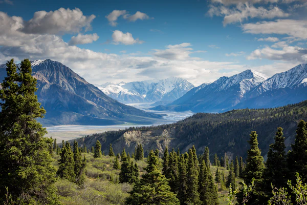
Trishul Viewpoint
Viewpoint0.5 km from GMVN
The iconic viewpoint near the GMVN Rest House offering unobstructed views of Trishul, Nanda Ghunti, and the entire Himalayan panorama at sunrise.
Baijnath Temple Group (24 km)
UNESCO Tentative Heritage24 km from Gwaldam
A magnificent group of 12th-century stone temples on the banks of River Gomti, dedicated to Lord Shiva. Remarkable Nagara-style architecture with intricate carvings.
Wan Village (Roopkund Trailhead)
Trek Base25 km from Gwaldam
The picturesque starting point of the Roopkund Trek, this remote village offers rustic charm, basic guesthouses, and the last settlement before the high-altitude wilderness.
Apple Orchards of Gwaldam
Orchard & NatureSpread around town
Gwaldam's apple and plum orchards are scattered across the hillsides. Visit during March-April for blossoms or August-September for harvest. Some homestays allow fruit picking.
Gwaldam Weather & Best Time to Visit
Gwaldam enjoys a pleasant climate for most of the year thanks to its moderate altitude of 1,708 meters. Summers are mild and perfect for sightseeing, while winters bring crisp cold air and the clearest Himalayan views. The monsoon season transforms the landscape into a lush green paradise but brings heavy rainfall and potential road disruptions.
| Month | Min Temp | Max Temp | Snowfall | Condition | Recommended |
|---|---|---|---|---|---|
| January | 2°C | 12°C | Rare | Cold Winter - Misty Mornings | No |
| February | 3°C | 14°C | Rare | Late Winter - Clearing Skies | No |
| March | 7°C | 18°C | None | Early Spring - Apple Blossoms | Yes |
| April | 10°C | 22°C | None | Spring Peak - Wildflowers | Yes |
| May | 14°C | 26°C | None | Pleasant Summer - Clear Views | Yes |
| June | 16°C | 28°C | None | Warm Summer - Pre Monsoon | Yes |
| July | 16°C | 24°C | None | Monsoon - Heavy Rainfall | No |
| August | 16°C | 24°C | None | Monsoon - Lush Greenery | No |
| September | 14°C | 24°C | None | Post Monsoon - Crystal Clear | Yes |
| October | 10°C | 22°C | None | Autumn - Best Visibility | Yes |
| November | 6°C | 18°C | None | Early Winter - Clear Peaks | Yes |
| December | 3°C | 14°C | Rare | Winter Begins - Cold Nights | No |
Spring: March - April
Apple blossoms, wildflowers, and rhododendron blooms. Temperature 7-22°C. Perfect for nature photography and gentle walks through flowering orchards.
Summer: May - June
Ideal for trekking and outdoor exploration. Temperature 14-28°C. Clear skies, lush greenery, and comfortable weather for the Roopkund trek preparation.
Monsoon: July - August
Heavy rainfall with potential landslides and road blocks. Beautiful lush greenery but travel can be unpredictable. Best avoided for first-time visitors.
Autumn: September - November
The finest Himalayan views with crystal-clear skies. Temperature 6-24°C. Post-monsoon clarity makes this the best season for peak-spotting and photography.
How to Reach Gwaldam
Gwaldam is well-connected by road as it sits on the Karnaprayag-Bageshwar highway. While there is no direct rail or air connectivity, the journey through the Kumaon hills is scenic and rewarding, passing through charming towns, terraced valleys, and dense forests.
By Air
Airport: Pantnagar Airport
Distance: 202 km from Gwaldam
Duration: 6-7 hours by road
Airlines: IndiGo, Air India Regional
By Train
Station: Kathgodam Railway Station
Distance: 180 km from Gwaldam
Duration: 5-6 hours by road
Trains: Ranikhet Express, Kathgodam Express, Uttarakhand Sampark Kranti
By Road - Route Options
From Delhi
430 km10-12 hoursRoute: Moradabad - Haldwani - Almora - Baijnath - Gwaldam
From Kathgodam
180 km5-6 hoursRoute: Bhimtal - Almora - Kosi - Baijnath - Gwaldam
From Karnaprayag
38 km1.5 hoursRoute: Direct mountain road via Tharali
From Kausani
38 km1.5 hoursRoute: Baijnath - Gwaldam (scenic route)
Local Transport in Gwaldam
Shared Jeep
Availability: Variable
Available from Karnaprayag and Baijnath
Private Taxi
Availability: On demand
Best for sightseeing around Gwaldam
Where to Stay in Gwaldam
Accommodation in Gwaldam is simple and budget-friendly, reflecting the town's unspoiled character. Government rest houses offer reliable basic stays, while homestays provide the most authentic experience with home-cooked meals and warm Kumaoni hospitality. For more options and luxury, nearby Kausani (38 km) has several resorts.
Government (GMVN & KMVN)
GMVN Tourist Rest House Gwaldam
GovernmentKMVN Tourist Rest House
GovernmentPrivate Hotels & Guesthouses
Hotel Himalaya View
Private HotelApple Orchard Homestay
HomestayTrishul View Guest House
Guest HouseNearby Alternatives
Hotels in Baijnath (24 km)
VariousKausani Resorts (38 km)
ResortAccommodation Tips
- Book GMVN or KMVN Rest House in advance during peak season (May-June, October)
- Homestays offer the best food experience - ask for authentic Kumaoni thali
- Carry extra warm clothing for winter as not all rooms have heaters
- Kausani (38 km) is a good alternative if Gwaldam options are full
- Confirm hot water availability before booking, especially in budget stays
- Most properties accept only cash - carry sufficient funds
Gwaldam Tour Packages 2026
Explore our handpicked Gwaldam packages designed for every type of traveler - from quick weekend escapes to immersive trekking expeditions. All packages include local expertise and seamless travel arrangements.
 Bestseller
Gwaldam Tranquil Escape
Accommodation | Meals | Transport | Sightseeing | Guide
 Adventure
Roopkund Trek via Gwaldam
Camping Gear | All Meals | Trek Guide & Porter | Permits | Transport from Kathgodam
PopularGwaldam & Kausani Twin Retreat
Accommodation | All Meals | Transport | Sightseeing | Tea Tasting
 Heritage
Kumaon Heritage & Nature Trail
Heritage Stays | All Meals | Transport | Temple Visits | Village Walks
Quick TripGwaldam Weekend Getaway
Homestay | Breakfast & Dinner | Transport from Kathgodam
Gwaldam Photo Gallery
Trishul Peak from GwaldamHimalayan Panorama at SunriseAncient Temples & CultureGwaldam Lake Serenity Oak & Pine Forest TrailsNanda Ghunti at Dawn
Frequently Asked Questions
Gwaldam is famous for its stunning panoramic views of the Trishul and Nanda Ghunti peaks, its position as the gateway between the Garhwal and Kumaon divisions of Uttarakhand, the serene Gwaldam Lake (Gwalnaag Tal), the Government Angora Farm, apple and oak forests, and its role as the starting point for the legendary Roopkund Trek. It is also known as a peaceful transit town on the Karnaprayag-Bageshwar route.
From Delhi, Gwaldam is approximately 430 km and takes 10-12 hours by road. The best route is Delhi - Moradabad - Haldwani - Almora - Baijnath - Gwaldam. You can drive, take a Volvo bus to Haldwani/Almora and then a local bus or taxi to Gwaldam. The nearest railway station is Kathgodam (180 km, 5-6 hours by road), and the nearest airport is Pantnagar (202 km, 6-7 hours by road). Overnight buses from Delhi to Almora or Karnaprayag are also available.
The best time to visit Gwaldam is March to June and September to November. Spring (March-April) brings apple blossoms and wildflowers. Summer (May-June) offers pleasant weather with temperatures of 14-28 degrees Celsius, ideal for treks. Autumn (September-November) provides the clearest Himalayan views with crisp air. Avoid July-August due to heavy monsoon rainfall, though the lush greenery is stunning if you do not mind rain.
Gwaldam Lake, locally known as Gwalnaag Tal, is a small but sacred lake located amidst dense oak forests near Gwaldam town centre. The lake is associated with the serpent deity Naag Devta, and the ancient Gwaldam Naag Temple sits on its banks. Surrounded by tall deodar and oak trees, the lake offers a peaceful atmosphere for meditation and nature walks. A gentle 1 km walk from the main road takes you to this tranquil spot.
The Government Angora Farm in Gwaldam is one of the few Angora rabbit breeding centres in India. Established to promote wool production in the hills, the farm breeds Angora rabbits whose fine wool is used to make premium shawls, caps, and garments. Visitors can take guided tours to learn about the rearing process, see the rabbits up close, and purchase Angora wool products at reasonable government prices. The farm is open from 10 AM to 4 PM.
Macchi Tal (Fish Lake) is a uniquely fish-shaped lake located about 2.5 km from Gwaldam town. The name comes from its resemblance to a fish when viewed from above. Surrounded by dense oak and rhododendron forests, the lake is accessible via a gentle trek through forest paths. The still, emerald waters reflect the surrounding trees and create a mesmerizing sight. It takes about 1-1.5 hours to reach on foot from Gwaldam, making it an ideal half-day excursion.
Yes, Gwaldam is the primary gateway to the Roopkund Trek. Most trekkers reach Gwaldam first and then proceed to Wan Village (the actual trailhead) which is about 25 km further. The 7-8 day trek passes through Bedni Bugyal, one of India's most beautiful alpine meadows, before reaching the mysterious Roopkund (Skeleton Lake) at 4,800m. Gwaldam offers the last proper accommodation, ATMs, and supplies before the trek begins.
Gwaldam offers spectacular panoramic views of the Himalayan ranges. The most prominent peaks visible are Trishul (7,120m), which dominates the skyline, Nanda Ghunti (6,309m), Nanda Devi (7,816m), Nanda Kot (6,861m), and Maiktoli (6,803m). On exceptionally clear days, Chaukhamba (7,138m) and even distant Panchachuli peaks are visible. The best viewpoint is near the GMVN Rest House, and early mornings from October to March offer the clearest visibility.
Gwaldam has limited banking facilities. There is one SBI ATM in the main market area, but it is not always functional or stocked with cash. The nearest reliable ATMs are in Karnaprayag (38 km) or Baijnath (24 km). It is strongly recommended to carry sufficient cash (Rs. 5,000-10,000) for your entire stay. Most hotels and shops in Gwaldam accept only cash, though some may offer UPI payments.
Gwaldam offers authentic Kumaoni and Garhwali cuisine. Must-try dishes include Kafuli (a spinach-fenugreek preparation cooked in iron karahi), Bhatt ki Daal (black soybean lentil), Chainsoo (slow-cooked black gram), Aloo ke Gutke (spiced potatoes), Baadi (a lentil cake preparation), and Jhangora ki Kheer (barnyard millet pudding). Local apples, walnuts, and seasonal fruits are also a treat. The GMVN Rest House and small dhabas near the bus stand serve these regional specialties.
Mobile network coverage in Gwaldam is moderate. BSNL has the best coverage throughout the town. Jio works reasonably well in the main market area and around the bus stand. Airtel has patchy reception. Vi (Vodafone-Idea) has minimal coverage. Data speeds are generally slow (2G-3G level). Some guesthouses offer basic Wi-Fi. If you need reliable connectivity, a BSNL SIM is recommended. Download offline maps before arriving.
Gwaldam is approximately 38 km from Kausani, taking about 1.5 hours by road via Baijnath. The scenic route passes through pine forests and offers glimpses of the Himalayan peaks. Baijnath, located midway, is worth a stop for its famous 12th-century Shiva temple group. Shared jeeps and local buses ply this route regularly. Many travelers combine Gwaldam and Kausani into a single trip.
Yes, Gwaldam can be visited during winter (December-February), but be prepared for cold temperatures ranging from 2 to 14 degrees Celsius. While snowfall is rare in Gwaldam itself, the surrounding higher peaks are snow-covered, offering breathtaking views. Roads remain generally open, though occasional fog and frost can cause delays. Accommodation options are limited in winter, so book in advance. Carry heavy woolens, thermals, and warm accessories.
Badhangarhi Temple is an ancient temple dedicated to Goddess Durga (locally called Badhan Garhi Devi), situated on a hilltop about 2 km from Gwaldam. The temple is revered by locals and offers panoramic views of the surrounding valleys and the Himalayan ranges. A short uphill trek through oak and rhododendron forests leads to the temple. It is particularly vibrant during Navratri festivals when devotees from surrounding villages gather for celebrations.
Gwaldam is excellent for family trips with children. The gentle terrain, clean air, and peaceful environment make it safe and enjoyable. Kids love visiting the Angora Farm to see the rabbits, the easy walk to Gwaldam Lake, and exploring apple orchards. There are no steep climbs required for the main attractions. The lack of commercialization means a more authentic and educational experience. However, medical facilities are basic, so carry a first-aid kit and any essential medicines.
Gwaldam and its surrounding areas are dotted with apple orchards, particularly the Royal Delicious and Golden Delicious varieties. The apple season runs from July to September, with peak harvest in August-September. During spring (March-April), the orchards are covered in beautiful white and pink apple blossoms, making it a photographer's delight. Some homestays are set amidst these orchards, offering guests the experience of plucking fresh apples. The apples from this region are known for their crisp texture and sweetness.
Gwaldam stands out from popular hill stations like Mussoorie, Nainital, and Manali in several key ways: 1) It is virtually untouched by mass tourism, offering genuine peace and solitude, 2) It sits at the unique junction of Garhwal and Kumaon, blending both cultural traditions, 3) The Trishul and Nanda Ghunti views are among the finest accessible by road, 4) It serves as a practical gateway for serious treks like Roopkund, 5) The Angora Farm is a unique attraction not found elsewhere, 6) Accommodation prices are significantly lower than commercialized hill stations.
The road to Gwaldam is a mix of National Highway and state roads. The stretch from Delhi to Haldwani is well-maintained NH. From Haldwani to Almora, the road is a good two-lane mountain highway. The Almora to Baijnath section is scenic and reasonably well-maintained. The Baijnath to Gwaldam stretch (24 km) involves winding mountain roads but is in fair condition. During monsoon (July-September), landslides can temporarily block roads. Always check road conditions before traveling during the rainy season.
The forests around Gwaldam are rich in biodiversity. Common bird species include Himalayan Monal (Uttarakhand's state bird), various species of woodpeckers, barbets, minivets, laughingthrushes, and flycatchers. The oak and rhododendron forests are home to Himalayan langur, barking deer, leopards (rarely sighted), porcupines, and various species of butterflies. The lakes attract migratory birds during winter. Birdwatchers should visit early morning near the lakes and forest trails for the best sightings.