

About Pithoragarh - The Little Kashmir of Uttarakhand
Nestled in the enchanting Soar Valley at an altitude of 1,514 meters, Pithoragarh is a hidden gem in the Kumaon division of Uttarakhand. Often referred to as the "Little Kashmir" due to its striking resemblance to the Kashmir Valley, this picturesque town is surrounded by towering Himalayan peaks, lush green terraced farmlands, dense pine forests, and sparkling mountain streams that create a landscape of extraordinary beauty.
What makes Pithoragarh truly significant is its role as the primary gateway to the sacred Kailash Mansarovar Yatra via the historic Lipulekh Pass. Every year, hundreds of pilgrims pass through this town on their spiritual journey to Mount Kailash in Tibet, undergoing medical checkups and acclimatization before ascending to the high-altitude border crossing at 5,334 meters. This ancient pilgrimage route has been used for centuries, making Pithoragarh a place of deep spiritual importance.
Beyond its spiritual significance, Pithoragarh offers awe-inspiring panoramic views of the magnificent Panchachuli peaks - five snow-capped summits that legend says are the hearths where the Pandavas cooked their last meal before ascending to heaven. The town's rich history is evident in the Pithoragarh Fort (London Fort), built by the Gorkhas and later controlled by the British, while ancient temples like Kapileshwar Mahadev and Nakuleshwar speak of a cultural heritage spanning millennia.
Little Kashmir
Beautiful Soar Valley resembling Kashmir
Kailash Mansarovar Gateway
Historic route via Lipulekh Pass
Panchachuli Panorama
Five legendary snow-capped peaks
Ancient Heritage
Gorkha fort & mythological temples
Kailash Mansarovar Yatra - The Sacred Journey
Pithoragarh holds a unique place in Indian pilgrimage tradition as the last major Indian town on the ancient route to Mount Kailash and Lake Mansarovar in Tibet. The Lipulekh Pass route, organized by the Ministry of External Affairs, starts the overland journey from Pithoragarh, making this town the spiritual launchpad for one of Hinduism's most sacred pilgrimages.
Yatra Route from Pithoragarh
Pithoragarh
1,514mMedical checkup, acclimatization (2-3 days)
Dharchula
915mBorder town, permits and documentation
Tawaghat
1,100mTrek begins, riverside camping
Gunji
3,200mAcclimatization camp, hot springs nearby
Lipulekh Pass
5,334mIndia-Tibet border crossing
Sacred Temples of Pithoragarh
Kapileshwar Mahadev
Type: Cave Temple (Lord Shiva)
Distance: 3 km from town
Feature: Natural stalactite Shivling
Significance: Sage Kapil meditation site
Nakuleshwar Temple
Type: Ancient Shiva Temple
Distance: 2 km from town
Feature: Kumaoni stone carvings
Significance: Founded by Pandava Nakul
Dhwaj Temple
Type: Mountain-top Shiva Temple
Distance: 18 km from town
Altitude: 2,100 meters
Significance: 360-degree Himalayan views
Thal Kedar
Type: Forest Temple (Lord Shiva)
Distance: 15 km from town
Feature: Natural spring, deodar forests
Significance: Sacred during Shravan month
Panoramic Views of Panchachuli Peaks
The Panchachuli range is the crowning glory of Pithoragarh's landscape. According to Hindu mythology, the five peaks represent the five hearths (chulhas) where the Pandavas prepared their last meal before ascending to heaven. These majestic snow-capped summits, visible from various points around Pithoragarh, create one of the most breathtaking mountain panoramas in the Indian Himalayas.
Panchachuli I
6,355mDistance: ~60 km
The westernmost peak of the range, visible clearly from Pithoragarh town
Panchachuli II
6,904mDistance: ~60 km
The highest and most prominent peak of the Panchachuli group
Panchachuli III
6,312mDistance: ~62 km
Central peak of the range with distinctive snow formations
Panchachuli IV
6,334mDistance: ~63 km
Known for its steep ridges and challenging climbing routes
Panchachuli V
6,437mDistance: ~65 km
The easternmost peak, mythologically linked to Draupadi
Other Visible Peaks
Trekking Trails from Pithoragarh
Pithoragarh district is a trekker's paradise, offering routes that range from easy day hikes to challenging multi-week expeditions through some of the most remote and beautiful Himalayan terrain. The treks here pass through ancient trade routes, pristine glaciers, and culturally rich tribal villages that few tourists have explored.
Panchachuli Base Camp Trek
8-10 Days | 72 km
Max: 4,250mOne of the most spectacular treks in Kumaon Himalayas, this route follows the ancient Darma Valley through pristine wilderness to the base of the magnificent Panchachuli peaks.
Start Point: Dharchula (via Pithoragarh) | Best Time: May - June, September - October
Khaliya Top Trek
2-3 Days | 12 km
Max: 3,500mA relatively easy trek from Munsiyari that rewards with one of the finest panoramic views of the Panchachuli range and surrounding Himalayan peaks.
Start Point: Munsiyari (via Pithoragarh) | Best Time: March - June, September - November
Milam Glacier Trek
10-12 Days | 118 km (round trip)
Max: 3,450mFollowing the ancient trade route between India and Tibet through the Johar Valley, this trek leads to the magnificent Milam Glacier, one of the largest in Kumaon.
Start Point: Munsiyari (via Pithoragarh) | Best Time: May - June, September - October
Darma Valley Trek
7-9 Days | 65 km
Max: 3,800mA culturally rich trek through the homeland of the Rung tribe in the remote Darma Valley, passing through traditional villages with unique architecture and customs.
Start Point: Dharchula (via Pithoragarh) | Best Time: June - September
Kumaoni Cuisine - Food of Pithoragarh
Pithoragarh offers an authentic taste of Kumaoni cuisine, which is known for its simplicity, nutritional value, and use of locally grown ingredients. The food here reflects the agrarian culture of the Kumaon hills, with dishes built around millets, lentils, local greens, and minimal use of oil.
Must-Try Main Dishes
Bhatt ki Churkani: Creamy black soybean curry, signature Kumaoni dish
Aloo ke Gutke: Spiced potato preparation with local herbs and red chili
Chainsoo: Slow-roasted black gram dal with garlic and cumin
Kafuli: Nutritious spinach and fenugreek curry cooked in iron kadhai
Dubuk: Thick whole lentil preparation with ghee and spices
Breads & Staples
Mandua Roti: Finger millet flatbread, rich in calcium and iron
Jhangora Kheer: Barnyard millet dessert, creamy and aromatic
Pahadi Rajma: Local red kidney beans cooked slowly with mountain spices
Jholi: Tangy yogurt-based curry served with steamed rice
Baadi: Sun-dried lentil dumplings, a traditional preservation method
Famous Sweets & Snacks
Bal Mithai
Roasted khoya coated with white sugar balls - Kumaon's most famous sweet from Almora
Singodi
Coconut and khoya sweet wrapped in Maalu (turmeric plant) leaf, unique to Kumaon
Arsa
Deep-fried rice flour and jaggery sweet, traditionally made during festivals
Sisunak Saag
Stinging nettle greens preparation, rich in nutrients and a mountain delicacy
Where to Eat in Pithoragarh
- Local dhabas near the bus stand serve authentic Kumaoni thalis at affordable prices
- KMVN restaurant at Chandak offers meals with mountain views
- Try the local chai stalls for authentic Kumaoni masala chai with jaggery
- Homestays offer the best home-cooked Kumaoni meals with family recipes
- The town market area has bakeries selling fresh breads and local snacks
- Ask locals for seasonal specials - Kafuli is best during winter months
Places to Visit in & Around Pithoragarh
From ancient forts and sacred temples to pristine valleys and wildlife sanctuaries, Pithoragarh and its surroundings offer a diverse range of attractions that cater to history buffs, pilgrims, nature lovers, and adventure seekers alike.
 Must Visit
Pithoragarh Fort (London Fort)
Historical Monument1 km from town center
Built by the Gorkhas in the early 19th century and later renamed by the British, this hilltop fort offers commanding views of the Soar Valley and surrounding mountains. A must-visit for history enthusiasts.
 Must Visit
Chandak Hill
Viewpoint7 km from Pithoragarh
The crown jewel of Pithoragarh sightseeing, offering unparalleled 180-degree views of the Panchachuli peaks and the entire Soar Valley. Perfect for sunrise and sunset photography.
Must VisitKapileshwar Mahadev Temple
Cave Temple3 km from town center
An ancient cave temple dedicated to Lord Shiva with natural stalactite and stalagmite formations. A naturally formed Shivling inside the cave makes it a unique spiritual destination.
Must VisitSoar Valley
Natural Valley0 km (Pithoragarh is in the valley)
The picturesque valley where Pithoragarh sits, with lush green terraced fields, crystal streams, and pine forests. Walking through the valley reveals why it is called Little Kashmir.
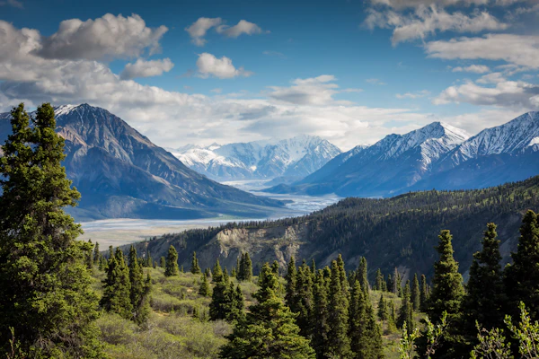
Dhwaj Temple
Mountain Temple18 km from Pithoragarh
A revered Shiva temple perched at 2,100 meters offering spectacular 360-degree Himalayan views. The moderate trek through dense forests is rewarding with panoramic mountain vistas.
Askot Wildlife Sanctuary
Wildlife Sanctuary54 km from Pithoragarh
A 599 sq km sanctuary established for the endangered Himalayan musk deer. Also home to snow leopards, bharal, black bears, and diverse bird species across multiple ecological zones.
Thal Kedar Temple
Forest Temple15 km from Pithoragarh
A serene Shiva temple nestled in dense deodar and pine forests with a natural spring. Known for its spiritual atmosphere and beautiful surroundings, especially during Shravan.
Nakuleshwar Temple
Ancient Temple2 km from town center
An ancient temple attributed to Nakul of the Pandavas, built in traditional Kumaoni style with intricate stone carvings. An important religious site with deep mythological connections.
Gangolihat (Mahakali Temple)
Pilgrimage Town77 km from Pithoragarh
Home to the famous Hat Kalika Temple, one of the 108 Shakti Peeths. The temple of Goddess Mahakali is revered by the Kumaoni Regiment and holds immense religious significance.

Jauljibi Confluence
Sacred Confluence78 km from Pithoragarh
The scenic confluence of Gori Ganga and Kali rivers, famous for the annual Jauljibi Fair held in November. An important trading point with a vibrant cultural heritage.
Pithoragarh Weather & Best Time to Visit
Pithoragarh enjoys a pleasant climate for most of the year due to its moderate altitude. Summers are warm and comfortable, winters are cold but not extreme, and the monsoon brings heavy rainfall. The best months for visiting are March to June and September to November when skies are clear and the Panchachuli peaks are visible.
| Month | Min Temp | Max Temp | Rainfall | Condition | Recommended |
|---|---|---|---|---|---|
| January | 2°C | 14°C | Low | Cold Winter - Clear Skies | No |
| February | 4°C | 16°C | Low | Late Winter - Warming Up | No |
| March | 8°C | 22°C | Low | Early Spring - Pleasant | Yes |
| April | 12°C | 27°C | Low | Spring - Blooming Season | Yes |
| May | 16°C | 30°C | Moderate | Summer - Warm & Clear | Yes |
| June | 18°C | 32°C | Moderate | Pre-Monsoon - Hot Days | Yes |
| July | 18°C | 28°C | Heavy | Monsoon - Heavy Rain | No |
| August | 18°C | 27°C | Heavy | Monsoon Peak - Landslide Risk | No |
| September | 14°C | 26°C | Moderate | Post Monsoon - Clearing | Yes |
| October | 10°C | 24°C | Low | Autumn - Crystal Clear Views | Yes |
| November | 6°C | 20°C | None | Late Autumn - Best Visibility | Yes |
| December | 3°C | 16°C | None | Early Winter - Cold Nights | No |
Spring/Summer: March - June
Best for sightseeing, trekking, and temple visits. Temperature ranges from 8°C to 32°C with clear mountain views. Rhododendrons bloom in March-April.
Autumn: September - November
Crystal-clear skies offer the best Panchachuli views. Comfortable temperatures (6°C to 26°C). Ideal for photography and trekking. November offers exceptional visibility.
Monsoon: July - August
Heavy rainfall, frequent landslides, and road closures. Leeches on forest trails. Mountain views obscured by clouds. Best avoided for all activities.
How to Reach Pithoragarh
Pithoragarh is well-connected by road from major cities in North India. While the journey is long, it passes through some of the most scenic Himalayan landscapes, making the travel itself an unforgettable experience.
By Air
Airport: Pantnagar Airport (Naini Saini)
Distance: 234 km from Pithoragarh
Duration: 7-8 hours by road
Airlines: Air India Regional, Alliance Air
By Train
Station: Kathgodam Railway Station
Distance: 217 km from Pithoragarh
Duration: 7-8 hours by road
Trains: Ranikhet Express, Kathgodam Express, Uttarakhand Sampark Kranti
By Road - Route Options
From Delhi
470 km12-14 hoursRoute: Moradabad - Haldwani - Almora - Pithoragarh
From Haldwani
210 km6-7 hoursRoute: Almora - Berinag - Pithoragarh
From Almora
118 km4-5 hoursRoute: Bageshwar - Berinag - Pithoragarh
From Tanakpur
151 km5-6 hoursRoute: Champawat - Lohaghat - Pithoragarh
Local Transport in Pithoragarh
Shared Jeep/Taxi
Duration: Varies
Most common local transport
Private Taxi
Duration: Full day
Best for sightseeing around Pithoragarh
Where to Stay in Pithoragarh
Pithoragarh offers accommodation ranging from government-run KMVN properties to private hotels and authentic homestays. For the best mountain views, consider staying at Chandak Hill. For convenience, the town center has several budget and mid-range options.
Government Properties (KMVN)
KMVN Tourist Rest House Pithoragarh
GovernmentKMVN TRH Chandak
GovernmentHotels & Resorts
Hotel Jhankar
Private HotelThe Grand Himalayan Resort
ResortHotel Tridev
Private HotelHomestays & Guesthouses
Pithoragarh Homestay
HomestayChandak View Guesthouse
GuesthouseSoar Valley Retreat
CottageAccommodation Tips
- KMVN Chandak offers the best views but needs advance booking during peak season
- Homestays provide authentic Kumaoni food and cultural experience
- Town center hotels are convenient for market access and transport connections
- During Kailash Mansarovar Yatra season (Jun-Sep), accommodations fill up quickly
- Winter stays should have room heaters - confirm availability before booking
- Carry cash as many properties do not accept cards
Pithoragarh Tour Packages 2026
Choose from our carefully curated Pithoragarh packages - from heritage walks and temple tours to challenging Himalayan treks and pilgrimage journeys. All packages include expert local guidance and seamless arrangements.
 Bestseller
Pithoragarh Heritage & Nature Explorer
Accommodation | All Meals | Sightseeing | Transport | Guide
 Adventure
Panchachuli Base Camp Trek
Camping Gear | All Meals | Guide & Porter | Permits | Transport
PopularPithoragarh & Munsiyari Combo
Accommodation | All Meals | Transport | Sightseeing | Trek Guide
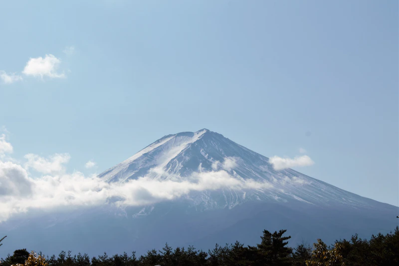 Pilgrimage
Kailash Mansarovar Prep Tour
Accommodation | All Meals | Transport | Medical Support | Guide
ExpertMilam Glacier Expedition
Camping Gear | All Meals | Expert Guide | Permits | Porter Support
Pithoragarh Photo Gallery
Panchachuli Peaks from ChandakSoar Valley PanoramaPithoragarh Fort Ruins River Valley ViewsHimalayan SunriseAlpine Meadows near Pithoragarh
Frequently Asked Questions
Pithoragarh is called the "Little Kashmir" because of its stunning natural beauty that rivals the Kashmir Valley. The Soar Valley surrounding Pithoragarh town resembles Kashmir with its lush green meadows, terraced fields, and panoramic views of snow-capped peaks. The valley is flanked by the Panchachuli range and offers a similar topography of gentle slopes, pine forests, and sparkling streams, earning it this beloved nickname.
Pithoragarh serves as the primary gateway for the Kailash Mansarovar Yatra via the Lipulekh Pass route. Pilgrims undergo mandatory medical checkups and acclimatization in Pithoragarh for 2-3 days before proceeding. The route goes from Pithoragarh to Dharchula, then through Tawaghat, Gunji, and finally to the Lipulekh Pass (5,334m) at the India-Tibet border. The Ministry of External Affairs organizes the yatra annually from June to September.
The Panchachuli is a group of five Himalayan peaks (ranging from 6,312m to 6,904m) named after the five hearths (chulhas) lit by the Pandavas during their final journey to heaven according to the Mahabharata. Yes, you can see all five peaks from Pithoragarh, especially from Chandak Hill (7 km from town), which offers the most spectacular views. The peaks are best visible on clear days during October-November and March-April.
Pithoragarh Fort, also known as London Fort, was built by the Gorkhas in the early 19th century during their rule over Kumaon (1790-1815). After the Anglo-Nepalese War, the British took control of the region and renamed it "London Fort" due to its strategic importance. The fort sits on a hilltop overlooking the Soar Valley and offers panoramic views. Though partially in ruins, it remains an important historical landmark and popular tourist attraction.
The best time to visit Pithoragarh is March to June (spring/summer) and September to November (post-monsoon/autumn). March-June offers pleasant weather with temperatures from 12-32 degrees Celsius, blooming rhododendrons, and clear mountain views. September-November provides the clearest skies for Himalayan views and comfortable weather. Avoid July-August due to heavy monsoon rains and landslide risks. Winters (December-February) are cold but offer snowfall at higher elevations.
From Delhi, Pithoragarh is approximately 470 km (12-14 hours by road). The most common route is Delhi - Moradabad - Haldwani - Almora - Pithoragarh. You can drive, take a bus (UTC/KMOU from Anand Vihar or Haldwani), or fly to Pantnagar Airport (234 km from Pithoragarh) and then take a taxi. The nearest railway station is Kathgodam (217 km). Alternatively, Tanakpur railway station (151 km) via Champawat is another option.
Chandak Hill is a scenic hilltop located 7 km from Pithoragarh town at an altitude of about 1,830 meters. It is famous for offering the most breathtaking panoramic views of the Panchachuli peaks and the Soar Valley. The hill has a KMVN tourist rest house, a temple, and well-maintained walking trails. It is an ideal spot for sunrise and sunset photography, nature walks, and peaceful meditation. The drive from Pithoragarh offers stunning valley views.
The Soar Valley is the beautiful valley in which Pithoragarh town is nestled. It stretches about 5 km in length and is renowned for its lush green terraced farmlands, crystal-clear streams, pine forests, and panoramic mountain views. The valley resembles parts of Kashmir with its gentle topography, which is how Pithoragarh earned its "Little Kashmir" nickname. The Soar Valley is surrounded by hills on all sides and offers excellent walking and photography opportunities.
Kapileshwar Mahadev is an ancient cave temple dedicated to Lord Shiva, located about 3 km from Pithoragarh town. The temple is set inside a natural limestone cave with stalactite and stalagmite formations. It is believed to be the meditation spot of Sage Kapil, after whom it is named. The cave has a naturally formed Shivling and water drips continuously over it. The temple is accessible via a short uphill walk and offers spiritual serenity amidst natural beauty.
Yes, Pithoragarh is considered very safe for solo travelers and women. The town has a small, close-knit community with very low crime rates. The local Kumaoni people are known for their warmth and hospitality. However, standard travel precautions apply - avoid traveling alone at night in remote areas, keep emergency contacts handy, and inform your accommodation about your daily plans. For treks and remote areas, hiring a local guide is recommended for safety and navigation.
Askot Wildlife Sanctuary (also called Askot Musk Deer Sanctuary) is located about 54 km from Pithoragarh and covers an area of 599 square kilometers across altitudes from 600m to 5,600m. It was established in 1986 primarily to protect the endangered Himalayan musk deer. The sanctuary is also home to snow leopards, bharal (blue sheep), Himalayan black bear, and various pheasant species. The diverse altitude range creates multiple ecological zones from subtropical to alpine.
Pithoragarh offers authentic Kumaoni cuisine. Must-try dishes include: Bhatt ki Churkani (black soybean curry), Aloo ke Gutke (spiced potato dish), Bal Mithai (local brown sugar chocolate sweet), Singodi (coconut sweet wrapped in Maalu leaf), Chainsoo (roasted black gram dal), Kafuli (spinach and fenugreek curry), Dubuk (thick lentil curry), and Jholi (yogurt-based curry). Local mandua (finger millet) rotis and fresh pahadi rajma are also specialties.
Dhwaj Temple is an ancient Hindu temple perched at an altitude of about 2,100 meters on Dhwaj peak, approximately 18 km from Pithoragarh. Dedicated to Lord Shiva, it is believed to be where Lord Shiva planted his flag (dhwaj). The temple offers spectacular 360-degree views of the Himalayas, including the Panchachuli range. The trek to the temple is moderate and passes through dense forests. It is especially popular during Maha Shivaratri when devotees make the pilgrimage.
Yes, Munsiyari is approximately 130 km from Pithoragarh (5-6 hours by road). It is often combined with a Pithoragarh trip for a complete Kumaon Himalayas experience. Munsiyari offers closer views of the Panchachuli range, the Khaliya Top trek, Birthi Falls, and access to the Milam Glacier trek. The road from Pithoragarh to Munsiyari passes through beautiful pine forests and river valleys. Many tour packages combine both destinations.
Pithoragarh town has decent mobile network coverage. BSNL, Jio, and Airtel work in the town area. However, signal weakens significantly in surrounding villages and trekking routes. Wi-Fi is available at some hotels. There are ATMs in Pithoragarh town (SBI, PNB, BOB). For treks and remote areas, carry sufficient cash and download offline maps. Satellite phones may be needed for extended treks in the Darma or Johar valleys.
Thal Kedar is a sacred Shiva temple located about 15 km from Pithoragarh, set amidst dense deodar and pine forests at an elevation of about 2,000 meters. The temple is dedicated to Lord Shiva and is known for its serene atmosphere and natural beauty. It can be reached by a motorable road from Pithoragarh followed by a short trek. The temple complex has a natural spring and offers beautiful views of the surrounding hills. It is especially revered during Shravan month.
For Pithoragarh, pack according to the season: Summer (March-June) - light layers, a warm jacket for evenings, sunscreen, sunglasses, comfortable walking shoes, rain jacket, hat. Winter (Nov-Feb) - heavy woolens, thermal innerwear, warm jacket, gloves, woolen cap, warm boots. Year-round essentials: medicines (altitude/motion sickness), first-aid kit, power bank, torch, reusable water bottle, insect repellent, and camera with extra batteries. For treks, add trekking boots, trekking poles, and rain gear.
Nakuleshwar Temple is an ancient temple dedicated to Lord Shiva, located near Pithoragarh town. According to mythology, it was established by Nakul, one of the five Pandava brothers from the Mahabharata. The temple is built in traditional Kumaoni architectural style with intricate stone carvings. It is an important religious site for locals and holds special significance during festivals like Maha Shivaratri and Shravan. The temple is easily accessible and offers a peaceful atmosphere for devotion.
Pithoragarh offers several adventure activities: trekking (Panchachuli Base Camp, Khaliya Top, Milam Glacier), camping at Chandak Hill and various alpine meadows, rock climbing on natural rock faces near the town, bird watching in Askot Sanctuary and surrounding forests, fishing in the Ramganga and Gori rivers, paragliding (seasonal, from Chandak Hill), mountain biking on forest trails, and photography tours. The district is also a base for high-altitude mountaineering expeditions to the Panchachuli peaks.
For Pithoragarh town and nearby attractions (London Fort, Chandak Hill, Kapileshwar Temple, Soar Valley), 2-3 days are sufficient. If you want to include Munsiyari and nearby attractions, plan for 5-6 days. For trekking to Panchachuli Base Camp, you need 10-12 days including travel. For Milam Glacier, plan 14-15 days. A comprehensive trip covering Pithoragarh, Munsiyari, and one trek requires 8-10 days. Factor in travel time from Delhi (1 day each way).